From the south
The Hook
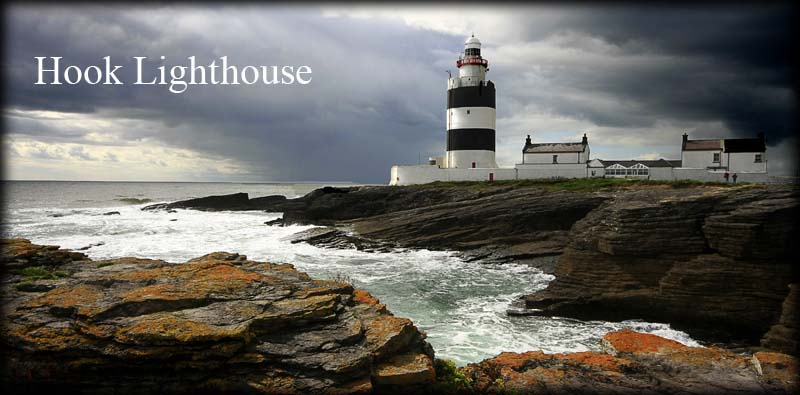
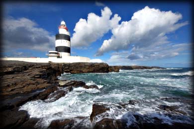
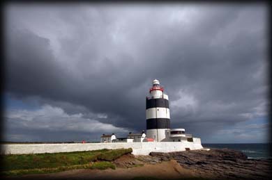
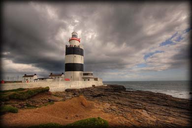
WOW ! Without doubt one of the main attractions in the southeast of Ireland, the medieval lighthouse on the Hook Peninsula, is a majestic sight with a fascinating history. St Dubhán, founder of a monastery in the 5th Century, established a beacon on the point to serve as a navigation aid for vessels entering Waterford Harbour. This beacon was tended by the monks for over 700 years. Interestingly, the word dubhán in the Irish language means fishing hook, later translated to The Hook or Hook Head, giving the point it's name. Some authorities attribute Norman Raymond LeGros with building the first tower in 1172 to raise the beacon. More recently, historians believe William Marshal (Earl of Pembroke) built the tower in 1245. Monks continued to tend the “beacon on a tower” until 1641. After a period of continuing shipwrecks, Hook was finally re-established in 1667.
Hook Tower was originally 18m high and approx 8.5m in diameter, but with expansions now stands at 46 metres. It may have had a glass lantern to shield the fire as early as the late 1600’s. Coal fire was replaced by twelve Argand oil lamps with reflectors at the end of the 1700’s. Coal gas replaced oil lamps in 1871 until 1910 when vaporised paraffin took over; this was replaced with electricity in 1972. This lighthouse managed to thrill us with every new angle of view. With it’s striking white and black banded tower accented by a red walkway, surrounded by a pounding sea onto a rocky promontory, this lighthouse is sure to delight every explorer. In 1996 keepers were withdrawn and the tower became remotely monitored. Today Hook Lighthouse is open to the public with a heritage centre and tours. For more info click here.
From the west
Situated: From Wexford take the R733 west to Balliniry, turn left onto the R734. After 5 kilometres turn right to stay on the R734, then take first right, then first left, travel for 9 kilometres then turn right. The Hook situated at the end of this road.
Discovery Map 76: X 7333 9739. Last visit Oct 2018.
Longitude: 6° 55' 45" W
Latitude: 52° 7' 25" N
Photos: Jim Dempsey and Deb Snelson.